Satellite Navigation Systems
[embedyt] http://www.youtube.com/embed?layout=gallery&listType=playlist&list=PLo4fIfJwYsWPZWHAzmjIN9YkSWCtkTGsU[/embedyt]
Read More Satellite Navigation Systems[embedyt] http://www.youtube.com/embed?layout=gallery&listType=playlist&list=PLo4fIfJwYsWPZWHAzmjIN9YkSWCtkTGsU[/embedyt]
Read More Satellite Navigation Systems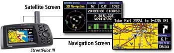
GPS The Global Positioning System (GPS) is a satellite-based navigation system made up of a network of 24 satellites placed into orbit by the U.S. Department of Defense. GPS was originally intended for military applications, but in the 1980s, the government made the system available for civilian use. GPS works in any weather conditions, anywhere […]
Read More What is GPS?
WAAS You’ve heard the term WAAS, seen it on packaging and ads for Garmin® products, and maybe even know it stands for Wide Area Augmentation System. Okay, so what the heck is it? Basically, it’s a system of satellites and ground stations that provide GPS signal corrections, giving you even better position accuracy. How much […]
Read More What is WAAS?Background The current state for instrument approaches to aerodromes in Europe varies from Non Precision Approaches (NPA) (with lateral guidance only) based on ground NAVAIDS or basic GPS, to Precision Approaches (PA) (with lateral and vertical guidance) based on ground ILS or MLS systems. With the introduction of the SBAS systems augmenting the American GPS […]
Read More Accelerating EGNOS adoption in Aviation
GNSS GIANT aims to support the introduction of EGNOS and Galileo services in the aviation market, while demonstrating that the required safety levels are maintained for the responsible authorities and show economic and operational benefits to end-users. Background For some time, ICAO has stated the recommendation to make the most extensive use of the available […]
Read More GNSS introduction in the aviation sector (GIANT)SBAS Background The use of EGNOS-based services needs to include an imperative step: to have a solid program of international collaboration available to foster support for the necessary infrastructure, and for enablers to be in place as soon as possible and covering the greatest area. The limited investment required and the high return makes the […]
Read More SBAS Implementation in ACAC and ASECNA regionsGalileo is Europe’s own global navigation satellite system, providing a highly accurate, guaranteed global positioning service under civilian control. It is inter-operable with GPS and GLONASS, the two other global satellite navigation systems. By offering dual frequencies as standard, Galileo will deliver real-time positioning accuracy down to the meter range. It will guarantee availability of […]
Read More What is Galileo?
EGNOS EGNOS (European Geostationary Navigation Overlay Service) is essentially Europe’s ‘pre-GALILEO’ system, its first concrete venture into satellite navigation. EGNOS is to deliver services based on GPS and Glonass signals, providing augmentation signals re-transmitted by geostationary satellites and a network of ground stations. EGNOS augments the two satellite navigation systems now operating, the US GPS […]
Read More WHAT IS EGNOS ?